Canada/USA Border Trivia
The border between Ontario and the USA is 2,760 km long, from the Ontario/Quebec/New York end in the east to the Ontario/Manitoba/Minnesota end in the west.
2,760 km.
How much of that is over water, and how much over land? Well, let’s see. from East to West we’ve got
- the St. Lawrence River
- Lake Ontario
- the Niagara River
- Lake Erie
- the Detroit River
- Lake St. Clair
- the St. Clair River
- Lake Huron
- the Whatever it is River in Sault Ste. Marie - excuse me, that'd be the "Saint Mary River"
- Lake Superior ...
And then an amazingly convoluted 880 km route, initially following the Pigeon River between Ontario and Minnesota, extends all the way to the Northwest Angle.
Seriously you should look at how convoluted that route is. The 1789 Treaty of Paris, which ended the Revolutionary War, defined the border.
The St. Lawrence/Great Lakes part was pretty easy - let’s just go right up the middle, let’s give all of Lake Michigan to the Americans but we only get half of Lake Ontario for some reason - but the route westward from Lake Superior must have been harder to define. Fortunately there were well-known routes that the voyageurs in their canoes had previously established.
But is it really all water?
Amazingly, no, it isn’t all water.
land borders between Ontario and Minnesota
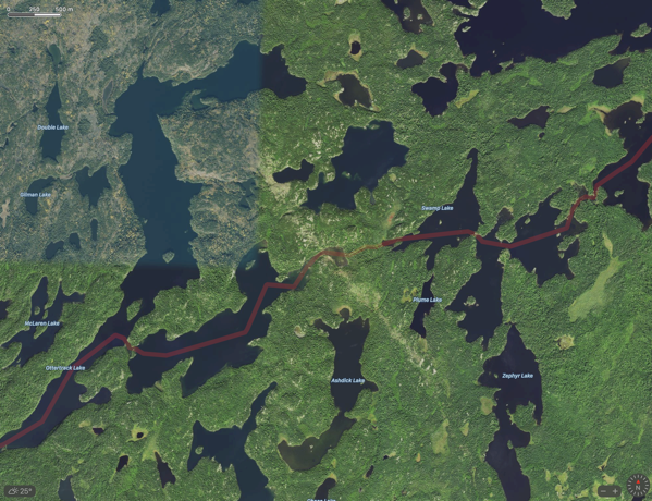
I know of at least three spots where Ontario and the USA share a land border. Two of them are in northwest Ontario, where there is a brief portage between one lake and another. Here’s one.

There’s another one up there. Go find it.
But how about this third one
land border between Ontario and New York State
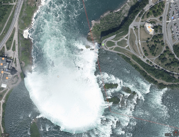
I suspect most people think the border at Niagara Falls zips right down the middle of the Horseshoe Falls - but it doesn’t. It cuts REALLY close to Goat Island on the American side. 99% of the Horseshoe Falls is in Canada but if you look really closely at the border line itself …

See it? Right there at the base of the falls on the US side? The border cuts through a few of the rocks piled at the bottom of the falls, and assuming those are dry, THAT is a land border between Ontario and New York.
Good luck crossing at that point though.
while we're at it
Everybody knows that if you go south out of Detroit, you get to Windsor.
Fewer people realize just how far Ontario stretches in a North - South direction.
There are places in Southern Ontario that are south of places in California, and there are places in Northern Ontario that are north of places in Alaska.